Culture · Chicago
Fort Dearborn’s Vanished Walls Still Mark a Chicago Crossroads
The fort built beside the Chicago River in 1803 disappeared through war, construction, fire and time. Its former site remains part of Chicago’s historic landscape.
By KLGBT News Desk ·
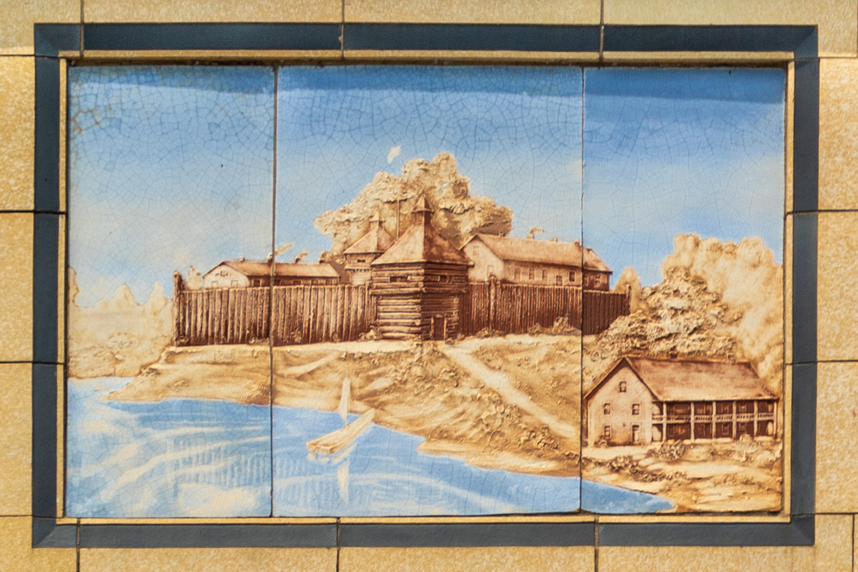
Long before Chicago’s downtown skyline, a military fort stood beside the Chicago River at a location that remains part of the city’s central historic landscape. Fort Dearborn was first constructed in 1803 by United States troops under Captain John Whistler. It was named for Henry Dearborn, who was serving as the nation’s Secretary of War.
The fort occupied a site connected to the Chicago River and the Chicago Portage, a crossing route between waterways. The available historical record offers limited information about human activity in the Chicago area before European explorers arrived, but it indicates that the region served as a passage for different peoples. In 1673, an expedition led by Louis Jolliet and Jacques Marquette became the first recorded group to cross the Chicago Portage and travel along the Chicago River. Marquette returned the following year.
Fort Dearborn’s first structure did not survive the War of 1812. It was destroyed after the Battle of Fort Dearborn, and a replacement was built on the same site in 1816. That second fort remained in operation until it was decommissioned in 1837.
The physical remains then diminished as Chicago changed around them. Widening of the Chicago River destroyed portions of the fort in 1855. A fire caused additional losses in 1857, and the remaining traces were destroyed in the Great Chicago Fire of 1871.
Although the fort itself is gone, its location has not disappeared from the city’s map. The site is now recognized as a Chicago Landmark within the Michigan–Wacker Historic District. It sits at the southern end of the DuSable Michigan Avenue Bridge, where contemporary movement through downtown overlaps with a place shaped by military construction, waterways, conflict and urban growth.
For Chicagoans encountering the site today, Fort Dearborn is less a surviving building than a layered historical reference. Its story connects the river to the portage, the early United States military presence to the city’s later expansion, and a vanished structure to a location still identified in the civic landscape. The absence of visible walls is part of that history: the fort was not removed in a single moment, but lost through destruction, rebuilding, infrastructure work and fire.
Source and reuse information This backgrounder adapts factual material from “Fort Dearborn” on Wikipedia: https://en.wikipedia.org/wiki/Fort_Dearborn The adapted text is released under the Creative Commons Attribution-ShareAlike 4.0 International license (CC BY-SA 4.0): https://creativecommons.org/licenses/by-sa/4.0/. This story has not been independently reviewed or fact-checked.
Further links listed by the Wikipedia page (not independently checked): - https://archive.org/details/chaptersfromilli00maso - https://archive.org/details/jeanbaptistepoin009076mbp - https://archive.org/details/discoveryconques00blan - https://archive.org/details/historyofchicago01inandr - https://archive.org/details/oldfortdearborn00currrich - https://archive.org/details/fortdearbornmass00helm Image rights Photograph description: Kirchbaum Building, 6560 N. Sheridan Road, Architect: Ronneberg, Pierce & Hauber. Constructed in 1922, the building has extensive exterior details in terracotta by the Northwestern Terra Cotta Co. A mural in terracotta of the growth of Chicago in a long panel is at the level of the upper floor. At left it features Fort Dearborn; the remainder of the mural has a skyline of the period featuring buil Creator: Paul R. Burley. License: CC BY-SA 4.0 (https://creativecommons.org/licenses/by-sa/4.0). Original image page: https://commons.wikimedia.org/wiki/File%3AKirchbaum_Building_Chicago_Illinois_Mural_Fort_Dearborn_2020-3406.jpg. The image was resized for display; no other changes were made.