Beyond the Bay · New York City
What to Know About Brooklyn’s Lafayette Avenue Subway Station
The Lafayette Avenue station serves Brooklyn’s Fulton Street corridor, but its name can be misleading: riders will not find an entrance directly on Lafayette Avenue.
By KLGBT News Desk ·
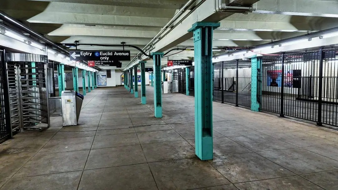
Brooklyn’s Lafayette Avenue station is an underground stop on the IND Fulton Street Line, located beneath the intersection of Lafayette Avenue and Fulton Street. It is a local station, giving riders access to the C train throughout the day and the A train during late-night hours, when the C does not operate.
The station’s name may create confusion for first-time visitors. Although Lafayette Avenue runs above the station, the station does not have an entrance on that avenue. The closest entrance is one block away, so riders heading to the stop should allow extra time to locate the stairway rather than looking for a doorway directly at the intersection.
The current subway station opened on April 9, 1936. Its arrival marked the replacement of the elevated BMT Fulton Street Line station that had previously stood above the site. That elevated station remained in service until May 31, 1940, when it closed.
Inside, the station has four tracks and two side platforms. Stairs from each platform lead to a lengthy mezzanine containing fare-control areas. Riders should be aware that the station does not provide a free connection between the two platforms. The arrangement of the fare-control space means there is no unrestricted crossover or underpass, so passengers need to enter the station on the correct side for their train whenever possible.
The station’s design includes details associated with the IND system. Both platform walls feature a light-green band outlined in dark green. Mosaic signs identify the station with white lettering on a dark-green field, framed by a lighter green border. Smaller tile captions beneath the trim repeat the station name in white lettering against black.
For riders using the station today, the key practical points are its service pattern, its set-back entrance, and its separated platforms. C trains serve the station except late at night, when A trains provide service instead. Because the nearest entrance is a block from Lafayette Avenue and the platforms cannot be freely crossed after entering, checking the train direction before descending can make the trip simpler.
The station’s history also reflects a broader change in Brooklyn transportation: an elevated stop that once occupied the corridor gave way to the underground IND station still serving the area. More than eight decades after its opening, Lafayette Avenue remains a small but distinctive part of the Fulton Street subway line, combining a 1930s station layout with details that reward a closer look.
Source and reuse information This backgrounder adapts factual material from “Lafayette Avenue station (IND Fulton Street Line)” on Wikipedia: https://en.wikipedia.org/wiki/Lafayette_Avenue_station_(IND_Fulton_Street_Line) The adapted text is released under the Creative Commons Attribution-ShareAlike 4.0 International license (CC BY-SA 4.0): https://creativecommons.org/licenses/by-sa/4.0/. This story has not been independently reviewed or fact-checked.
Further links listed by the Wikipedia page (not independently checked): - https://maps.google.com/maps?f=q&source=s_q&hl=en&geocode=&q=Av+of+the+Americas+nyc&sll=37.0625,-95.677068&sspn=34.450489,76.552734&ie=UTF8&hq=&hnear=Avenue+of+the+Americas,+New+York&ll=40.686187,-73.974413&spn=0.003856,0.013433&z=17&lci=transit&layer=c&cbll=40.686097,-73.974395&panoid=VTqD1BH0ESH8u8W7MTrsZg&cbp=12,114.48,,0,8.23 - https://maps.google.com/maps?f=q&source=s_q&hl=en&geocode=&q=Av+of+the+Americas+nyc&sll=37.0625,-95.677068&sspn=34.450489,76.552734&ie=UTF8&hq=&hnear=Avenue+of+the+Americas,+New+York&ll=40.685886,-73.973372&spn=0.003856,0.013433&z=17&lci=transit&layer=c&cbll=40.685977,-73.973395&panoid=sWMxJGuQQtaFmgnioV19cg&cbp=12,61.03,,0,6.47 - https://maps.google.com/maps?f=q&source=s_q&hl=en&geocode=&q=Av+of+the+Americas+nyc&sll=37.0625,-95.677068&sspn=34.450489,76.552734&ie=UTF8&hq=&hnear=Avenue+of+the+Americas,+New+York&ll=40.685943,-73.973393&spn=0.003856,0.013433&z=17&lci=transit&layer=c&cbll=40.685628,-73.973344&panoid=csHHiK5tOYWmI5fNA9eKQg&cbp=12,306.81,,0,2.3 - https://maps.google.com/maps?f=q&source=s_q&hl=en&geocode=&q=Av+of+the+Americas+nyc&sll=37.0625,-95.677068&sspn=34.450489,76.552734&ie=UTF8&hq=&hnear=Avenue+of+the+Americas,+New+York&ll=40.685666,-73.972857&spn=0.003856,0.013433&z=17&lci=transit&layer=c&cbll=40.68571,-73.972951&panoid=gJ76J9YD3ju4UwAvGBm9Tg&cbp=12,54.66,,0,1.41 - https://www.google.com/maps/@40.6859627,-73.9734039,3a,75y,277.67h,91.67t/data=!3m8!1e1!3m6!1s-EMno39Acw1w%2FWHGII-WNpBI%2FAAAAAAAAZeg%2FOsrVQYW5s90HeI5qoPhtuxdnxE2CBK_vgCLIB!2e4!3e11!6s%2F%2Flh5.googleusercontent.com%2F-EMno39Acw1w%2FWHGII-WNpBI%2FAAAAAAAAZeg%2FOsrVQYW5s90HeI5qoPhtuxdnxE2CBK_vgCLIB%2Fw203-h100-p-k-no%2F!7i8000!8i4000!4m3!8m2!3m1!1e1 - https://select.nytimes.com/gst/abstract.html?res=FB0D11F63A54107A93C3A9178DD85F448485F9 Image rights Photograph description: The Lafayette Avenue Station on the IND Fulton Street Line Creator: Kidfly182. License: CC BY 4.0 (https://creativecommons.org/licenses/by/4.0). Original image page: https://commons.wikimedia.org/wiki/File%3ALafayette_Avenue_Station_008.jpg. The image was resized for display; no other changes were made.