Beyond the Bay · Pittsburgh
Mt. Lebanon: A Pittsburgh First-Ring Suburb Shaped by Transit and Home Rule
Mt. Lebanon’s development reflects Pittsburgh’s outward growth, from a farming community to a transit-connected suburb and home-rule township south of Downtown.
By KLGBT News Desk ·
Mt. Lebanon is a township in Allegheny County located about four to six miles south of Downtown Pittsburgh. Its position places it among the communities most closely connected to the city while retaining its own municipal history and governing structure.
The area began as a farming community. European settlers arrived in 1773 and 1774 after acquiring land from the descendants of William Penn, while other early settlers purchased property from Pennsylvania’s state government. Before it became an independent township, the area was part of Scott Township, which had earlier connections to the now-defunct St. Clair Township.
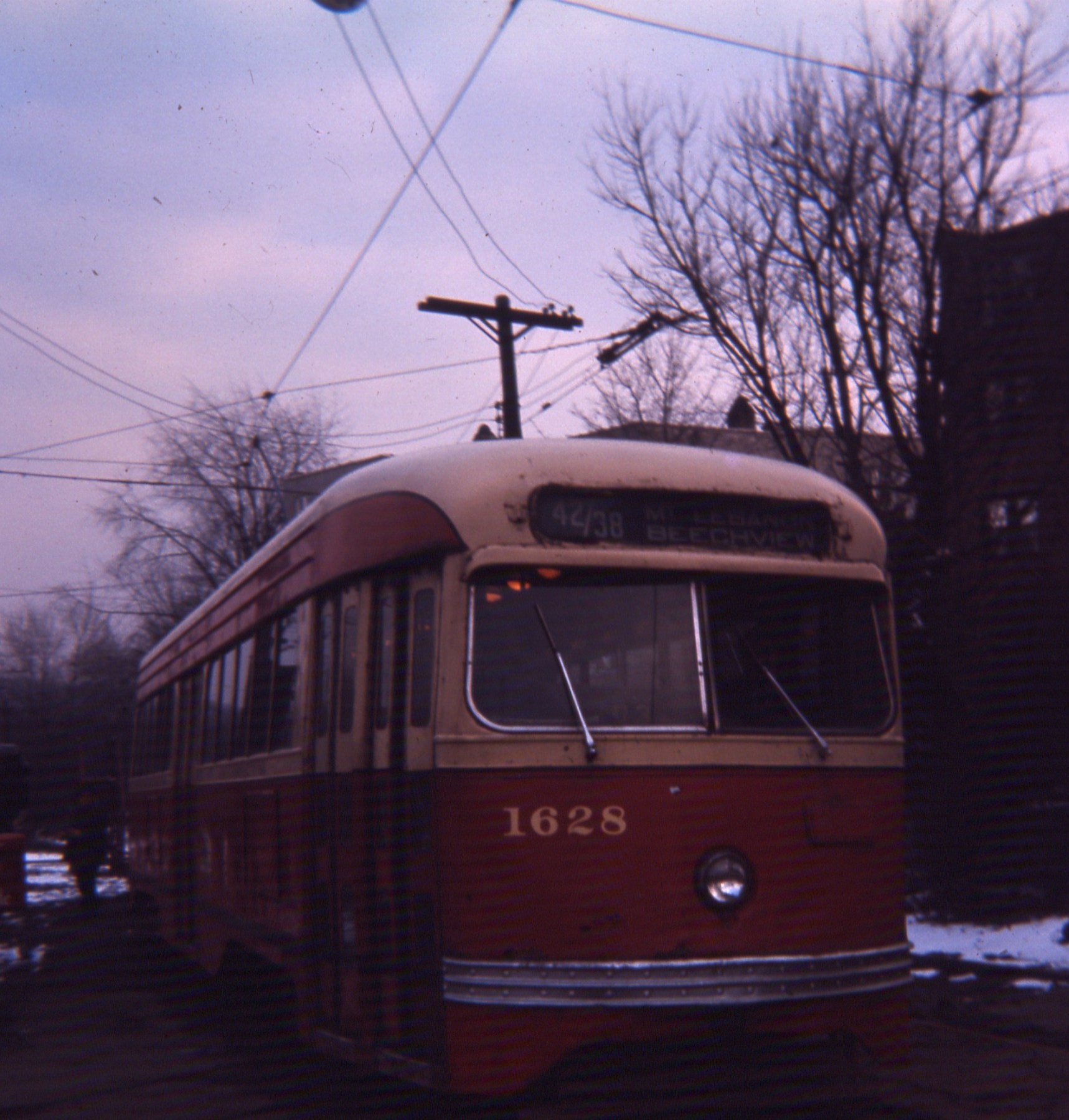
Mt. Lebanon’s transition from rural settlement to suburb accelerated in the early 20th century. Transit lines and a real estate subdivision helped establish it as a streetcar suburb in 1901, making access to Downtown Pittsburgh easier. That connection to the city was strengthened again when the Liberty Tunnel opened in 1924, improving automobile travel between the suburb and Pittsburgh.
In 1912, the community incorporated as a First Class Township under Pennsylvania law. More than six decades later, it adopted a home rule charter in 1975, becoming one of the first Pennsylvania communities to do so. Home rule gave the township a distinct framework for local government. The same charter also changed the community’s official name from “Mount Lebanon” to “Mt. Lebanon.”
The name itself predates that change. The source account notes that two Cedar of Lebanon trees were planted on Washington Road near the top of the area in 1850, while also indicating that the community’s naming history is more complicated than a simple explanation based on those trees.
For Pittsburgh readers, Mt. Lebanon’s history offers a concise example of how transportation and municipal organization shaped the region’s suburban landscape. Its early growth followed the arrival of streetcar service and planned development; later access was supported by a major tunnel connection; and its governmental identity evolved through incorporation and home rule. The result is a community closely tied to Pittsburgh’s downtown but defined by its own township government and historical trajectory.
As a first-ring suburb, Mt. Lebanon occupies a place in the metropolitan area’s inner landscape: near enough to benefit from direct links to the city, yet separate enough to develop an independent civic structure. Its story runs from agricultural settlement through streetcar-era expansion to modern local governance, providing context for understanding the communities immediately surrounding Pittsburgh.
Source and reuse information This automatically generated backgrounder adapts text from “Mt. Lebanon, Pennsylvania” on Wikipedia: https://en.wikipedia.org/wiki/Mt._Lebanon,_Pennsylvania The adapted text is released under the Creative Commons Attribution-ShareAlike 4.0 International license (CC BY-SA 4.0): https://creativecommons.org/licenses/by-sa/4.0/. The source article’s linked references are provided below where available. This story has not been independently reviewed or fact-checked.
Further links listed by the Wikipedia page (not independently checked): - https://web.archive.org/web/20070821090834/http://www.washingtonroad.com/ - https://www2.census.gov/geo/docs/maps-data/data/gazetteer/2016_Gazetteer/2016_gaz_place_42.txt - https://web.archive.org/web/20090412203801/http://www.hsmtl.org/history-of-mount-lebanon-1/how-mt-lebanon-got-its-name - https://web.archive.org/web/20110913040427/http://www.pacode.com/secure/data/302/chapter27/chap27toc.html - https://web.archive.org/web/20070927082258/http://www.mtlebanon.org/DocumentView.asp?DID=18 - https://web.archive.org/web/20080612122613/http://www.mtlebanon.org/index.asp?Type=B_DIR&SEC=%7B24D913FD-1EBA-4D86-84D6-A698382827CA%7D Image rights Photograph description: 19660226 14 PAT PCC Clearview Loop, Mt. Lebanon, Pennsylvania Creator: David Wilson from Oak Park, Illinois, USA. License: CC BY 2.0 (https://creativecommons.org/licenses/by/2.0). Original image page: https://commons.wikimedia.org/wiki/File%3A19660226_14_PAT_PCC_Clearview_Loop%2C_Mt._Lebanon%2C_Pennsylvania.jpg. The image was resized for display; no other changes were made.