LGBTQ+ · San Francisco
Eureka Valley and the Castro: A San Francisco Neighborhood Shaped by LGBTQ+ History
Eureka Valley combines a largely residential setting with the Castro, a nationally recognized center of San Francisco’s LGBTQ+ community and a neighborhood marked by decades of social and political change.
By KLGBT News Desk ·
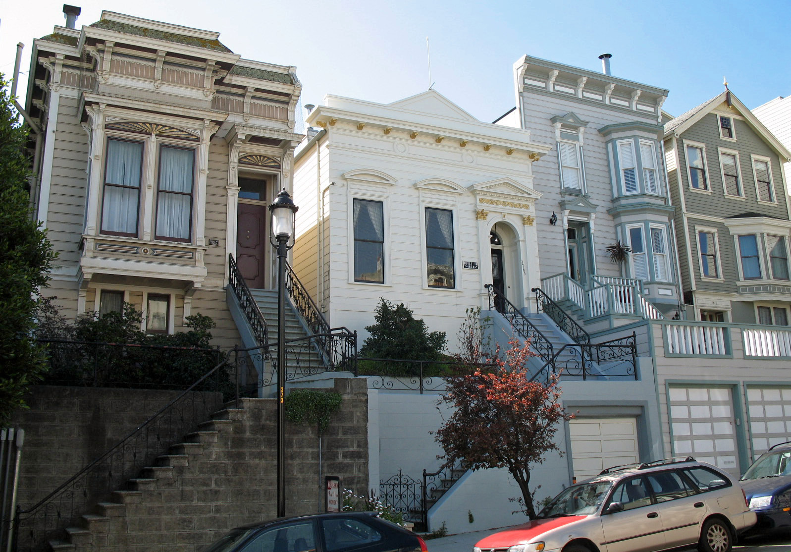
Eureka Valley is a San Francisco neighborhood best known for the Castro, a sub-neighborhood that draws visitors from across the city. Although much of Eureka Valley is described as quiet and residential, its streets are also closely associated with LGBTQ+ life, community identity and political history.
The area’s public character is visible in the rainbow flags displayed throughout the neighborhood. Those symbols sit within a broader history of change. Eureka Valley was initially a working-class Irish neighborhood. The loss of factory employment, followed by the movement of gay residents into the Castro during the 1960s, helped transform the area’s social and cultural landscape.
That transformation also became part of San Francisco’s political history. In 1977, district voters elected Harvey Milk to the San Francisco Board of Supervisors. He was the first openly gay politician elected in California, according to the supplied historical account. His election connected the neighborhood’s growing LGBTQ+ presence with representation in city government.
The boundaries of Eureka Valley depend on which local definition is used. San Francisco’s Planning Department officially groups the area within a larger Castro/Upper Market neighborhood. A definition associated with the Castro/Eureka Valley Neighbors Association, and also used in a 2007 Planning Department study, places Eureka Valley between Sanchez Street on the east, 22nd Street on the south, Twin Peaks on the west and Duboce Avenue on the north.
Under that outline, Eureka Valley borders Noe Valley to the south and the Mission District to the east. It includes several smaller areas, including the Castro and Duboce Triangle. These overlapping names reflect the way San Francisco neighborhoods can function both as planning categories and as places with distinct community identities.
For LGBTQ+ San Francisco, Eureka Valley is therefore more than a residential district or a visitor destination. It is a physical setting where demographic change, neighborhood culture and electoral history intersect. The Castro’s visibility gives the larger area a strong public profile, while the surrounding streets retain the residential character that has long been part of Eureka Valley’s identity.
Taken together, the neighborhood’s geography and history explain its enduring importance in the city’s LGBTQ+ story: a former working-class area reshaped by economic change and gay migration, marked by visible pride symbols, and linked to a milestone in California political representation.
Source and reuse information This automatically generated backgrounder adapts text from “Eureka Valley, San Francisco” on Wikipedia: https://en.wikipedia.org/wiki/Eureka_Valley,_San_Francisco The adapted text is released under the Creative Commons Attribution-ShareAlike 4.0 International license (CC BY-SA 4.0): https://creativecommons.org/licenses/by-sa/4.0/. The source article’s linked references are provided below where available. This story has not been independently reviewed or fact-checked.
Further links listed by the Wikipedia page (not independently checked): - https://web.archive.org/web/20100811230319/http://www.sfplanning.org/Modules/ShowDocument.aspx?documentid=682 - https://www.govtrack.us/congress/members/CA/11 - https://geohack.toolforge.org/geohack.php?pagename=Eureka_Valley,_San_Francisco¶ms=37.76594_N_122.43093_W_ - https://geohack.toolforge.org/geohack.php?pagename=Eureka_Valley,_San_Francisco¶ms=37.76594_N_122.43093_W_type:city(12503) - https://web.archive.org/web/20090829203438/http://www.sfpl.org/librarylocations/branches/eurekavalleyhistory.htm - https://www.kqed.org/w/hood/castro/castroHistory.html Image rights Photograph description: National Register of Historic Places in San Francisco, California. 3762 - 3773 20th St, Liberty Hill Historic District, San Francisco, California, USA. Photographed 2008-03-23 by Mike Hofmann from the north side of 20th St. between Dolores and Guerrero Sts. Camera location 37° 45′ 30.24″ N, 122° 25′ 29.28″ W View this and other nearby images on: OpenStreetMap 37.758400; -122.424800 Creator: Sanfranman59. License: CC BY-SA 3.0 (https://creativecommons.org/licenses/by-sa/3.0). Original image page: https://commons.wikimedia.org/wiki/File%3ALiberty_Hill_Historic_District_(San_Francisco).JPG. The image was resized for display; no other changes were made.