Culture · Virginia Beach
Virginia Beach Oceanfront: A Guide to the Boardwalk and Its History
The Virginia Beach Oceanfront centers on a three-mile boardwalk, nearby residential areas and the Atlantic-side routes that connect hotels, attractions, streets and trails.
By KLGBT News Desk ·
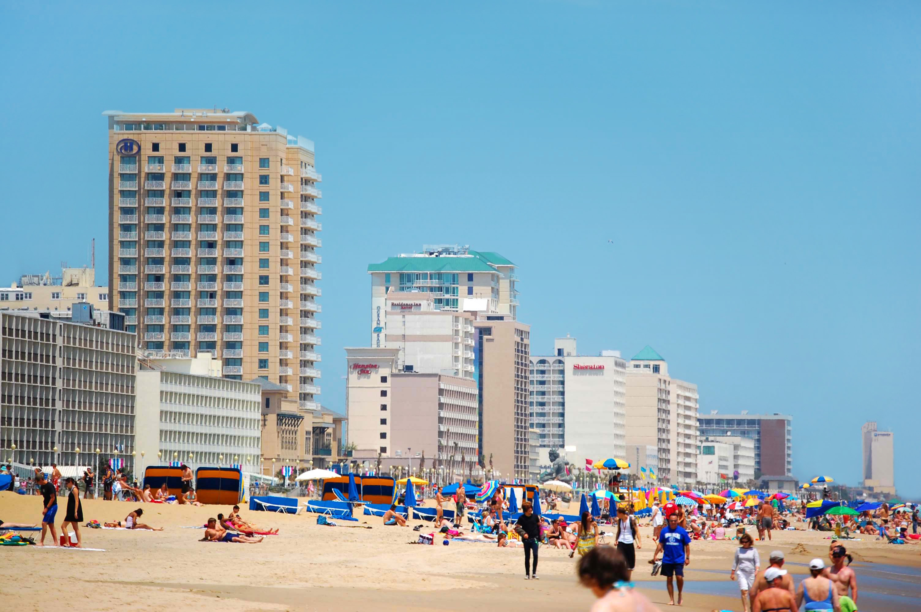
The Virginia Beach Oceanfront is the city’s main seaside tourism district, organized around a three-mile stretch of boardwalk along the Atlantic Coast. The area also includes the North End residential neighborhoods. Its southern boundary is described in relation to the Rudee Inlet Bridge, while First Landing State Park lies to the northwest. Together, the boardwalk, Atlantic Avenue and Pacific Avenue form the principal routes through this part of eastern Virginia Beach.
For residents and visitors—including LGBTQ people looking for a clear sense of the city’s public waterfront—the Oceanfront is best understood as a connected transportation and leisure corridor rather than a single attraction. The boardwalk is about 27 feet wide and provides a pedestrian route alongside a separate path for bicycles. Those routes connect approximately 40 hotels and other attractions, as well as nearby trails and surface streets. That layout makes the Oceanfront a setting for moving between lodging, recreation and the broader street network on foot or by bike.
The current boardwalk is the result of a major update completed in 1988, but the waterfront’s tourism history reaches back much further. Passenger rail service arrived in 1883, helping tourism in Virginia Beach expand. The Virginia Beach Hotel soon opened and provided the area’s first overnight accommodations, giving summer visitors a place to stay near the shore.
Construction on the original boardwalk began in 1888. Unlike the present concrete structure, the first version was made from wooden planks and covered five blocks. During the Gilded Age, the walk ran alongside Peacock Ballroom, a performance venue associated with artists such as Duke Ellington, Cab Calloway and Tommy Dorsey. That history places entertainment alongside transportation as an early part of the Oceanfront’s identity.
Today, the district combines layers from those different eras: a resort landscape shaped by rail travel, a historic shoreline promenade and a modern pedestrian-and-bike corridor. Its position near First Landing State Park and its links to surface streets make it part of a larger network rather than an isolated strip of beachfront. For anyone new to Virginia Beach, the Oceanfront offers a useful starting point for understanding how the city’s coastal tourism, built environment and public routes developed together.
Source and reuse information This automatically generated backgrounder adapts text from “Virginia Beach Oceanfront” on Wikipedia: https://en.wikipedia.org/wiki/Virginia_Beach_Oceanfront The adapted text is released under the Creative Commons Attribution-ShareAlike 4.0 International license (CC BY-SA 4.0): https://creativecommons.org/licenses/by-sa/4.0/. The source article’s linked references are provided below where available. This story has not been independently reviewed or fact-checked.
Further links listed by the Wikipedia page (not independently checked): - https://www.virginiabeach.com/articles/virginia-beach-boardwalk-history-cavalier-hotel - https://www.virginiabeach.com/attractions/fishing/virginia-beach-oceanfront-fishing-pier - https://web.archive.org/web/20080820161144/http://vbfun.com/ - https://www.virginiabeach.com/article/virginia-beach-boardwalk-history-cavalier-hotel - https://web.archive.org/web/20110725051226/http://www.visitvirginiabeach.com/pressroom/mediakits/VB2011/pdfs/2011HistoricalBackgrounder.pdf - https://geohack.toolforge.org/geohack.php?pagename=Virginia_Beach_Oceanfront¶ms=36.8425_N_75.9725_W_region:US-VA_type:landmark Image rights Photograph description: Virginia Beach, Virginia on Memorial Day 2009 Creator: gargola87 from Virginia Beach, VA. License: CC BY-SA 2.0 (https://creativecommons.org/licenses/by-sa/2.0). Original image page: https://commons.wikimedia.org/wiki/File%3AVirginia_Beach_waterfront.jpg. The image was resized for display; no other changes were made.